")
.
.
We use the French term quartier, meaning ‘quarter’, to refer to a walkable neighbourhood. A walkable neighbourhood or quartier is planned with a core and periphery pattern. At the centre, a public space or urban room functions as a meeting place with local service and retail outlets providing neighbourhood amenities. Nearby there is a transit connection. The core of the quartier can also be a segment of the strip along the arterial. Both the arterial and the other streets within the quartier are designed to support walking and social functioning. Within the quartier planning is focused on enhancing the human experience of place.
Within a 5 minute walking distance of this core a quartier will cluster a residential population. Using the urban house as the model, the quartier population will be about 20,000 people. It is the synergy between the resident population, the provision of services and transit at the core, and an urban footprint designed for walking that makes the quartier or the walkable neighbourhood a distinct element in urbanism.
A quartier is generally defined as a circle with a quarter-mile radius from the centre (approximately a 5 minute walking distance). The area within the circle encompasses about 120 acres of land. The quartier is the measure of human scale on the urban footprint. It represents the area of urban land that we can come to know on foot as part of the daily habits that form from living in one place over a period of time. Due to its efficient use of land and human-scale, high-density quartiers are seen as an effective alternative to high-rise tower developments. Because they are in-keeping with Vancouver’s historic urbanism, they are seen as the clear choice for incremental residential intensification in both the Historic District, and the neighbourhoods at large.
The Vancouver Historic Quartiers present walkable urbanism as a sustainable model for urbanism that will accommodate human functioning in socially mixed, high density, high quality, low-carbon, walkable neighbourhoods or quartiers. Neither the spectre of advancing gentrification, nor the 50-year history of social stratification offer sustainable alternatives. We must strike out in a new direction.
* * *
.
1. Vancouver’s Historic Quartiers
- 1865 Hastings Mill & Townsite
- 1870 Granville Townsite (Gastown)
- Chinatown
- Strathcona
- Industrial Quartier (no name)
- 1863 Hastings Townsite
- The Drives
The Hastings Townsite Government Reserve was established in 1863, located just west of the Pacific National Exhibition. However, save for the opening of the Douglas Road from New Westminster by the Royal Engineers in 1860, the Government townsite failed to attract development. Thus, while its dates are early, and its platting unique, its development does not take place in the formative years of our city.
Vancouver’s Historic Quartiers originate with the establishment of the Hastings Mill in 1965, soon to become the going concern on the south shore of Burrard Inlet. In 1870 the Granville Townsite (Gastown) was platted against the western boundary of the Hastings Mill lands. By that time Gastown already boasted saloons, hotels, and government services.
Rapid change came to the area in the early 1880’s with the construction of the Canadian Pacific Railway. Once the site for railway terminus was decided, the City of Vancouver was incorporated in 1886, and the plan for the City of Vancouver, drawn by the CPR, was registered the following year. Chinatown and Japantown benefited from regular CPR steamship service to Asia beginning in 1891.
The Hastings Government Townsite would not develop until after the PNE was established in the early 1900’s. The area between Hasting Mill Townsite and the Hastings Townsite also developed in the early 1900’s when it was subdivided as a series of twelve ‘Drives’.
.
.

1886 CPR Survey of Hastings Mill Site
Maj. J.S. Matthews, Early Vancouver Vol. 3 (Vancouver, City of Vancouver, 2011) p.78.
.
2. The Hastings Mill Townsite
The mill townsite, comprised of buildings that housed and serviced the resident work force, was re-plated by the CPR in 1884. The lots laid out on the north side of the new Railway Avenue replaced various cottages and structures numbered 1 − 13 and 66 − 68 in the map. The railway tracks themselves would cut further into the townsite requiring the demolition of still more buildings. However, the mill itself remained in operation into the late 1920’s.
The significance of the Hastings Mill Townsite is that it provided the focus for the new settlements forming within easy walking distance around its perimeter. Thus, Granville was platted to be not more than a five minute walk away. When new cottages built on what is today land south of Hastings, or Strathcona, these lots were also within an easy walk of the mill gate, and the services available there. Japantown and Chinatown also developed within walking reach of the mill townsite.
Even after the townsite disappeared, and later after the mill itself closed down, the place relationships established by the daily habits of the early inhabitants of the townsite remained. As a result, walking in these streets today Railway Avenue, Japantown, Oppenheimer Park, Hastings Street, Strathcona, Main Street, Chinatown, and Gastown, all appear in quick succession, one after the other. On foot in these places there is always something else coming around the next corner.
The lesson in urbanism is about the primacy of the founding place, and the permanence of the relationships established between these early quartiers, their walkability, proximity and mix. If we structure our new settlements with such characteristics, then these will be just as amenable to walking. Furthermore, if we reclaim Vancouver’s Historic Quartiers as neighbourhoods, then we will also recover their urban functioning.
Map Key
- Mill foreman’s house.
- Rev. T.G. Thompson’s house.
- Surgery & Doctor’s office.
- Stevedore’s house.
- R.H. Alexander’s barn.
- R.H. Alexander’s house (The mill manager’s house. The small wing at the rear was the first mill manager’s house, one Capt. J.A. Raymur).
- Fence.
- Hastings Mill Road connecting to Granville-Hastings Road.
- Hastings Mill school house.
- House.
- Mechanical engineer’s house.
- Caulfield Bros.
- Water tank.
- Calvert Simson’s house, shopkeeper.
- Main Office.
- The Old Old Mill Store; later used as a warehouse.
- Cook House and Dining Hall for employees.
- Open water.
- Boardwalk.
- The New Old Mill Store, now at Alma Road.
- Wharf shed.
- Open sawdust. General athletic ground, lacrosse, etc.
- Mill refuse fire.
- Mill proper.
- Machine shop, engine room, smoke stacks.
- Oil house.
- Blacksmith shop.
- End of flume above ground; then underground to cookhouse.
- Little water tank at end of flume.
- Cottage.
- Cottage.
- Library and Mechanic Institute
- Fire engine, hand pumped.
- Bachelors kitchen.
- Saw filer’s house.
- Mill foreman’s house.
- Cottage.
- Two duplex cottages.
- Bachelor’s shack.
- 43. Bummer’s Hall, recreation.
- 44 − 46 Cottages.
- 47 − 48. Water tank connected with flume from Trout Lake
- 49 − 54. Cottages for mixed races; no Chinese.
- 55 − 68. Cottages for all races.
- 69. Road to Granville and Hastings. Two-plank sidewalk on the beach side to Granville (Gastown) from the mill.
- 70. St. James’ Church on the beach.
- 71 Westminster Avenue (Main Street).
- 72. Gore Avenue (skid road).
- 73. Dunlevy Avenue.
.
.

Settlement Areas in the Old East End
.
3. The Old East End
Combining historical analysis, and a charrette to understand the meaning of place, we have identified the key settlement areas at the time of the arrival of the Canadian Pacific Railway—the corporation that picked the name “Vancouver” for its pacific terminus. These are:
- The Hastings Mill Townsite (wiped out by the railway. The blocks closest to the mill gate are designated Railway Ave. on the map).
- Japantown
- Gastown (The Granville Townsite)
- Chinatown
- Cottage lots that would be dubbed “Strathcona” in the 1950’s.
Aboriginal people were among the groups barred from land ownership. Although their presence here preceded European and Asian immigration by millennia, because they did not own land there is no district or neighbourhood that carries their name.
Railway Avenue was platted by the CPR as a kind of demarcation point. It was the first block of urban land immediately south of the CPR tracks. The curve of the street, first shown on 1884 plans, follows exactly the bend in the railway’s main trunk. That bend in the tracks itself follows the contours of the land—tacking to the sea, and following the topography—to stay on level ground. The tracks wipe out the entire Hastings Mill Townsite. Folks living there were made to find lodging elsewhere.
These five districts are Vancouver’s Historic Quartiers, evolving within easy walking distance of one another; hard-wired to the intersecting urban spines of Main & Hastings Streets; and serviced by an extremely walkable plan. As the charrette demonstrated—even today—walking from Gastown to Chinatown, Japantown, Strathcona, and the Railway Avenue is not only easy, but extremely convenient and pleasurable.
The coming of the railway did not change the physical relationships between the five original quartiers. It changed the fortunes of some residents who were forced from Hastings Mill Townsite, and others who chose the more fashionable (and white) West End. New arrivals from Asia and Europe took their place helping to galvanize the urbanism of this site with know-how imported from distant urban places.
The real damage came with the advent of Modern planning. The concept of a metropolis trading on agriculture and natural resources inspired a vision that would usurp every foot of coastline for industrial purposes. The natural settlement points for aboriginals and newcomers were re-zoned industrial in 1929. The ensuing decades saw the onslaught of the automobile. The pressures that attended suburbanization would deal the Cradle of our City its most severe blows.
In spite of it all, the urbanism of this wonderful place remains more or less intact, presenting quantifiable characteristics that we can measure and map. The first is the tendency of urban settlements to evolve distinct footprints. We have studied their shape and relationships to learn something about the primary elements of a walkable urbanism. The second is that the Old East End was the first place in Vancouver to accept a high level of social mix, and embrace the cultural diversity of its inhabitants.
The platting of the historic quartiers was born partly out of necessity, and partly in response to a superb natural site during the 1860’s, 70’s, 80’s and 90’s. Contour maps reveal the relationship of this land to the inlet as that of a gently sloping terrain washed by sea breezes. Historians tell us that at high tide it was possible to take a small craft from False Creek to Burrard Inlet on the low land along Raymur Avenue (John Atken), or Carrall Street (Maj. Mathews).
Internally the neighbourhoods were organized for walking. The long axis of the city blocks parallel the coast and the (eventual) urban spine. Thus, a walking route would start at the front or read door, reach the end of the block, then head towards the urban spine. A jaunt along Hastings Street would find goods, services and transit. Throughout, the quartiers are sprinkled with convenience stores and cafés—another bit of urbanism abandoned by Modern planning.
The charrette demonstrated the potential for this area to infill with 35,000 new residents using historically compatible, human-scaled, high-density urban houses. Thus, a sensitive redevelopment of the Vancouver Historic Quartiers will make growth the engine of change; correcting the injuries borne by the urban and social fabric; safeguarding against the risk of gentrification; and establishing in our city and region a new model for urban intensification and sustainable urbanism.

Pedestrian Sheds & Urban Spines
.
4. Pedestrian Shed Analysis
We can map human-scale and walkability in the Vancouver Historic Quartiers—i.e. the Old East End—by superimposing circles or pedestrian sheds measuring 120 acres or 0.5 km2 on the five original areas of settlement. Each pedestrian shed has a radius equal to the distance of a 5-minute walk. The plan also shows the crossing of Hastings and Main Streets, Vancouver’s first urban spines.
Historical analysis helps us pin-point with accuracy the centre of the first pedestrian shed—the Hastings Mill gate, the point of origin for our city. The second pedestrian shed is centred on Water Street, in the Granville Townsite plat, following the urbanist tradition of placing the heart or core of waterfront towns on the water’s edge. The third covers Chinatown, from its roots in Shanghai Alley to its present footprint. The fourth encompasses the cottage lots of what would come to be known as Strathcona after 1950. The fifth and final pedestrian shed lies mostly over the water, capturing the site of the Roger’s Sugar Refinery built on land granted to the industrialist by the City of Vancouver.
The pattern drawn by these five pedestrian sheds is unmistakable: a core-periphery pattern structures the Vancouver Historic Quartiers. The place of origin—the Hastings Mill Townsite—claims the centre, and a ring of new settlements bands around it. This pattern persists to this day, some one hundred and fifty years since the mill began operations. We expect it to last in perpetuity. Such is the resilience of urban settlement.
The pedestrian shed analysis reveals the rationale for the location of Hastings Street. Functioning as an urban spine it strings together the first areas of settlement. The 1887 Hamilton Plan for Vancouver took no pains in extending Hastings Street west as far as the end of the peninsula. Heading in the opposite direction, one mile to the east, Hastings Street reaches Hastings Townsite.
Chinatown stands out for having developed within a well-defined pedestrian footprint. Originally, the shape of Chinatown was constrained by the restriction forcing Chinese Canadians to buy land inside a narrowly circumscribed zone. Yet, even after the ban was lifted Chinatown retained a boundary that corresponds to the human experience of place.
Strathcona also retains a human-scale boundary. Extensions East, including Vernon Drive, probably belong to the opening of new neighbourhoods along the path of the Hastings streetcar. It is notable that the two Modernist Housing Projects that book-end Strathcona today serve to isolate the cottage lots even as they continue blighting neighbourhood character.
.
 The East End in 1890
.
5. The urbanism of the Old East End
This is the Cradle of our City. The East End plan from 1890 shows the origin of the City of Vancouver, Canada’s capital on the fiery Pacific Rim. John Atkin tells us that this area was know as “[T]he East End… until the 1950’s when the planners began using the name Strathcona”:
Strathcona, Vancouver’s first neighbourhood, has been called a slum, “home of the working man,” and absolutely charming. Starting out as a collection of shacks and cottages around the Hastings Mill, it developed into a residential area that quickly moved south and east away from the mill…
John Atkin, Strathcona: Vancouver’s First Neihbourhood, P. 1. (Note: historical dates below are from this source).
As the Charrette demonstrated, unlocking the mystery surrounding the Vancouver Historic Quartiers requires deciphering a lost urban past:
- First, by identifying the footprint of historic settlements to rediscover the physical relationships underlying the oldest parts of the city;
- Then, by reclaiming the quartiers from the injuries of Modern planning, thus returning to full functioning these viable urban places.
John Atkin’s map (reproduced here with color enhancements) shows the first site where western urbanism took root on Burrard Inlet. A short portage at high water along the low-land along Raymur Avenue would take a canoe from inlet to creek saving the long paddle around Stanley Park, according to Atkin.
Our study identifies that these areas predate the railway—and platting by the CPR. With no authority in place to mediate between the CPR’s best interest and the public good, the best interests of The Company won out. In the early decades Vancouver’s urbanism rode the fate of boom-and-bust economic cycles without the benefits of good urban design. Some would argue the dilemma persists into our day.
Hard on the heels of CPR platting, the advent of Modern planning saw the rise of a cultural epoch that turned a back on historic values. Not surprisingly, the Old East End was targeted for complete and total eradication. As the century wore on Modern planning pitted one tradition against the other intentionally creating winners and losers. The famous Freeway Fight; the plan to raze Strathcona and rebuild it as Social Housing Projects; and labelling the Old East End areas as “blight”, then renaming them as “Strathcona” and the “Downtown Eastside” were all tactics of Modern planning in the suburban age.
Yet, what we see in John Atkin’s plan of the East End circa 1890 is a place anyone would feel proud to call ‘home’ supported by urban amenities few recognize today, including:
- Hastings bisects the quartier providing ready access to public transportation within easy walking distance of every East End front door.
- Grove Crescent, on the south side, is a promontory looking out over the tidal flats of False Creek that filled with water at high tide.
- A second Crescent, Railway Avenue—the plan fails to represent its true curving nature—is a unique piece of urban planning created by the CPR to redesign Hastings Mill’s manager’s row. The names of the mill managers and the names of the directors of the real estate company they founded—including Oppenheimer, Dupont, Barnard, Prior, Powell, Alexander, Campbell and Raymur—dot the map.
- Westminster Avenue (renamed Main Street)—with a bridge built in 1872—connects to the East End’s first suburb, Mount Pleasant, and the Provincial capital of New Westminster beyond.
- Boundary Street sets the western edge of a quartier three-quarters of a mile wide. Gastown is one mile to the west of Boundary Street; and Hastings Townsite is one mile to the east.
- Later subdivision would rename Boundary as “Glen Drive” the first of the twelve “drives” platted in the land lying between the Old East End and the Hastings Townsite.
- Hastings Mill, the original employment site, crowns the East End within easy walking distance of every home. The arrival of the CPR and the construction of the railway right-of-way severed the physical link between the mill and its resident population.
- Gore Avenue, the only street that does not align to the cardinal points, follows the path of the original “Skid Road,” a trail used to skid logs to the mill site with teams of horses. The road bed was built of logs, in a manner known as a corduroy road.
- Chinatown, the land set aside for Asian settlement, consisted of the blocks on the first Princess Street (renamed Pender) between Main and Carrall streets. As the map clearly shows, the south side of the first Princess Street fronted on water. The lots extending into the tidal flats had buildings set on piles.
- Hogan’s Alley, home to an ad hoc concentration African families, was located in the vicinity of Park Lane on the east side of Main Street, on the lane running between Prior and Barnard (Union) streets.
- Japantown, the land set aside for Japanese settlement, lies along Powell Street on the two blocks east of the mill’s Skid Row (Gore Ave.).
- “By the time the century turned [1900], Strathcona had started to become a neighbourhood of individual homes reflecting their owner’s tastes. The sidewalks were wooden planks and the streets were paved in wooden blocks.” (John Atkin, Strathcona: Vancouver’s First Neihbourhood, P. 29).
.

The Old East End: 1929 Detail: Bartholomew Plan Zoning Plan
.
6. The Smoking Gun
In 1929, at the moment of amalgamation of the City of Vancouver with Point Grey and South Vancouver, the St. Louis planning firm of Harland Bartholomew presented its final draft of A Plan for the City of Vancouver, British Columbia. Shown above is a detail with color enhancements from Plate 50: Zoning Map of the Bartholomew plan. Compared to the John Atken plan of the same area in 1890, the place is barely recognizable. All has been rubbed out by the slashing lines that denote the two new zones: “Heavy Industrial” and “Light Industrial” land uses.
“The principle of zoning” is the new idea introduced by Modern planning. It is applied here in 1927 to the oldest settled area in Vancouver. The other dominating issue in the Bartholomew Plan for Vancouver is “paving the way”: building a road network to accommodate the unfolding onslaught of the private automobile. In the characteristic manner of Modernism, the importance of historical preservation for urbanism is not addressed. An excellent historical analysis of urban development in Vancouver to 1929 is presented in the first pages of the Bartholomew Plan under the title “Introduction”.
This is the point in time when the idea takes concrete form about eliminating the old East End altogether. Zoning the entire area for non-residential uses is the gun that fires the bullet that wreaks all the havoc, damage and human suffering we see taking place in the area from 1930 to the present. This is a planned, wholesale destruction of a place that by 1930 had a 65-year history as a continuously inhabited residential district. Modernism did not win. The neighbourhood held out, and the urbanism is still in place. Albeit, under severe urban stresses that we will describe.
The principals stages in the strategy for doing away with the East End are:
- 1929 New Zoning Plan.
- 1950’s and 1960’s: Construction of Social Housing Projects; and renaming areas south of Hastings as “Strathcona”.
- Circa 1965: The Freeway Plan.
- 1970: Re-routing commuter traffic to neighbourhood streets once the Freeway Plan is defeated (Water, Powell, Cordova, Hastings, Main, Union and Venables).
- 1980s – present: Renaming areas north of Hastings the “Downtown East Side”; then “DEOD: Downtown Eastside Oppenheimer District”; and locating social housing in an area of warehouses; high traffic levels; and low level and quality of neighbourhood amenities.

7. Vancouver’s Historic District
- Historic sites restored (black)
- Historic sites needing restoration (red)
- Extant buildings not expected to change (white)
The footprint of a historic district is not difficult to establish. It consists of that part of the city with the greatest concentration of historic buildings standing, or demolished.
In Vancouver—as shown on the map—the concentration of historic buildings suggests that the historic district extends east from Gastown to Oppenheimer Park and beyond; and from Fasle Creek north to the railway.
Our interest in Vancouver’s Historic Quartiers goes beyond historic preservation. We look to the historic neighbourhoods for lessons in urbanism. We want to understand the measurable characteristics that speak to the walking experience of place from a time when walking was the primary mode of transportation.
The imperative to retain original buildings is best understood at the scale of the urban landscape as a whole, rather than one building site at a time. From the point of view of the single property owner, historic preservation presents economic disadvantages. All else being equal, maximizing floor area on any given site realizes the greatest economic return. However, historic districts presenting an entire area built according to principles long ago repressed begs a different question.
In these places difference becomes a competitive advantage. People seek out historical places for their uniqueness. Thus, the benefit flowing to any one individual site in the Historic District derives from the critical mass presented by the district as a whole.
The birth of a city is a unique event never to be repeated. It is a unique moment in time. Historic Districts preserve that legacy in a concrete and palpable place. Communities typically embrace their places of origin in an spirit of celebration and self-assertion.
Furthermore, our city’s historical birth place holds special meaning for us now that we search for a new and more sustainable urbanism. Before 1930 cities were conceived entirely at the human scale. Designed at the scale of the quartier, city blocks were clustered around a central public space to function as a cohesive, walkable neighbourhood.
Thus, the value of the historic 19th century urbanism can not be realized by the preservation of individual building sites. In order to experience the ethos, the preservation of pre-modern districts require engaging the place as a whole. This approach is the antithesis of granting special favours to individuals who will build far in excess of historic density and massing. Building “in keeping” with the neighbourhood was the driving concern in this city’s founding period. Thus, heritage policy going forward should identify a balanced approach to historic preservation at the individual site, with an eye to achieving overall results at the scale of the block and quartier as a whole.
In keeping with this methodology, the charrette build out assumes no new area on sites with buildings built before 1930.

Water and Cambie Streets
8. Gastown (Town of Granville, Provincial Government Townsite, platted in 1870)
Prior to the coming of the railway, Gastown was as a one-street commercial district serving the Hastings Mill population, and all who came either along the bridge built over False Creek from New Westminster, or by boat to its tiny pier. All remaining unsold lots were granted to the CPR on 13 February, 1886 by the Provincial Government.
With the location of the first railway station immediately to the west, and the extant condition of the surrounding land as a timbered wilderness, Gastown became the first beneficiary of the energy and development forces unleashed by the new enterprise. In the summer of 1886 a fire that started at a CPR clearing site on False Creek, spread to Gastown and quickly wiped out all its wood buildings. Brick buildings were soon erected in their place. The Alhambra Hotel was first, occupying the SE corner of Water and Carrall Streets. A two storey office building was built across the street home to the CPR land sales office.
Cordoba Street was Vancouver’s first “downtown”. Water Street developed with hotels lining the south sidewalk and warehouses fronting on the other side of the street, skirting the railway and the coastline. A spur was cut from the south shore of Burrard Inlet to False Creek that just nipped the original townsite plat at its south-east corner, forming today’s Pigeon Park. That railway spur was eventually used by the B.C. Electric streetcar.
Gastown’s years of decline ensued as the “downtown” followed the directives of CPR land management. First, it relocated to Hastings Street. Then, it migrated up Granville Street to Georgia Street, the site of three consecutive CPR hotels. We can find no other traces in the urbanism driving these moves except land speculation and sales.
The revitalization of Gastown came in 1970, one of the finest efforts at historic preservation in Canada. The street space was re-interpreted as a continuous ground plane, using bollards to exclude cars from pedestrian areas. Decorative lighting was installed that had no historical precedent in the city, but conveyed instead the reinterpretation of the site as a pedestrian precinct. Historic preservation continues apace into the present day producing fine examples of building re-use, and re-interpretation.
However, not all the new moves have been welcomed. Modernism finally established a foot-hold on Water Street with the opening of the ‘Storeum’… An unfortunate enterprise that laid bare the worst aspects of cruise ship tourism. An out-of-scale modernist structure was erected with a stage for the actors who would tell the story of the urbanism on display just outside the front door. The second intrusion of exactly the wrong kind of urbanism arrived in our historic district at the hands of a local architect. The Woodward’s Department Store block was razed to the ground in the anachronistic 1950’s tabula rasa manner, and a set of Modern towers was erected in its place. The Alhambra Hotel addition dealt a similar blow to the historic character of the place in the same time period.
The Charrette envisions a new era for Gastown founded on the extension of sound preservation principles to all the Vancouver Historic Quartiers. Holding in check the forces of Modernism once again, the Historic Quartiers would be returned to full social, economic and environmental function through incremental infill with historically compatible built form, and urbanism.

Keefer Street Sidewalk Shopping
.
9. Chinatown Revitalization
We’ve gone a little “Condo Crazy” in the last decade or two in Vancouver. Towers can work in a few, unique places like the downtown peninsula. However, as we turn to the intensification of our neighbourhoods—including our historic neighbourhoods—we must strike in a new direction.
We can achieve high-densities equivalent to tower products with human-scale buildings. Our historic neighbourhoods or quartiers are uniquely set up to show us the way since they were designed with just that kind of build out in mind.
Five Keys for Revitalization
We agree that there is a need for change in planning policy. However, we see HAHR as the wrong kind of change. Our Chinatown is both culturally and historically significant. In 2011 we are confident about national recognition, and I hope it receives UNESCO designation.
We have identified 5 key elements for planning revitalization in historic Chinatown:
1. In Vancouver we have two of the most successful examples in urban revitalization in North America: Granville Island and Gastown.
Imagine that the streets in Granville Island looked like Keefer and Pender Street… What would become of Granville Island’s success story? Imagine Gastown’s sidewalks, decorative lighting, and pavements all ripped out and fitted with the pavements, sidewalks, and street poles from Historic Pender Street. How would Gastown be faring?
When we say “Chinatown Revitalization” the markets want to know that we mean business. Involvement from all levels of government, and investment in the millions of dollars for Chinatown Street Beautification, is the signal investors are waiting for.
2. We can achieve hi-density with human scale product that is in-keeping with the historic 2, 3 & 4 storey building tradition of Chinatown. Building towering condos over 100-year old buildings will bring the kind of damage from which historic districts do not recover.
3. Financing.
Benevolent Societies may well partner with non-profits and the public sector to secure the future of their historic buildings, and bolster their social mission. Tax increment financing; density transfers out of Chinatown; partnerships with private sector NGO’s; and participation by provincial and federal governments, is the right funding strategy. It can replace land lift profits and CACs flowing from the wrong kind of development.
4. Dedicating street space to buses can turn trolleys and B-lines into Bus Rapid Transit.
Public investment in infrastructure and transportation will trigger incremental re-development by the private sector. We were told as much by Mayor Adams from Portland.
5. Revitalization Puts the Spotlight on Civic Leadership.
The private sector is ill equipped to lead this process. Successful revitalization hinges on intangibles like our community galvanizing behind a Historic Site we may have been too racially self-conscious to fully embrace in the past.
Leadership is the proper role for City Hall. Chinatown has an urbanism like no other in our city. Let us resolve now to strike in a new direction.
Presented by Lewis N. Villegas to City Council, 7 april 2011 at the Chinatown Historic Area Height Review.
.
.

.
10. DEOD: Warehouses, Social Housing and High Volume Traffic
- Social Housing (Mocha)
- Redevelopment sites; currently 1 & 2 storey buildings (blue)
The map shows one of the most startling results discovered during the Charrette. The area shown includes most of the a City of Vancouver zoning district called: “Downtown Eastside Oppenheimer District” (DEOD). The bulk of the district is bounded by: Alexander Street (north); Hastings Street (south); Main Street (west) and Heatley Avenue (east).
.

It is no surprise to find social housing in this area. Nor is it a surprise to see one and two storey concrete block warehouse buildings. The surprise is seeing them together; and experiencing on foot the results that this mixing of uses obtains. Further complicating this choice of district for the concentration of Social Housing are the unmitigated high volumes of traffic on Water-Powell, Cordova and Hastings Street. In addition to the social challenges, and the near-lack of any neighbourhood amenities, in this place high volumes of traffic impart a daily burden.
.
.

Powell Street in Japantown
.
11. Revitalization in Japantown
Japantown is clustered on the 300 and 400-block Powell Street. On the south side of the 400-block Powell is Oppenheimer Park, playing a vital role for the commuinity along with peripheral sites that speak to family and community life. The charrette sees this area moving away from industrial uses imposed in the post-war years, and turning back to its mixed-use neighbourhood roots.
The potential for residential infill is very high. Yet, realizing this potential must follow on the construction of social housing in sufficient numbers to deal with two issues:
- Homelessness
- Replacement of single room occupancy hotels (SROs)
Another key for the revitalization of Japantown is the return of Powell and Cordova streets to two-way neighbourhood streets. Such a reversal will be transforming. However, it will only be possible with the implementation of BRT/LRT on Hastings Street bringing additional trip capacity to the area.
.

Plan of Japantown
.
- Historic sites (black)
- Redevelopment “in-keeping” with local heritage (red)
- Redevelopment sites (blue)
- Social housing (mocca)
- Cultural/Civic/Utility sites (gold/orange)
- Buildings not expected to change (white)
.
Birmingham & Wood (2008) together with eight partnering consultants have provided the base material for an accurate assessment of Historic Japantown.
John Atkin in “Strathcona: Vancouver’s First Neighbourhood” describes the plight of the Japanese community during World War II:
The nine thousand Japanese Canadians in Vancouver were forced to give up their homes, businesses, and possessions because of the alleged threat they posed to Canada. Life for the Japanese community had been centred on Powell Street, which functioned very much like Chinatown does today. In the neighbourhood many of the local grocery stores closed and homes were vacated as members of the community mustered at the livestock buildings at the PNE before being dispersed across the country. Teachers recalled, in Strathcona School’s hundreth-birthday publication Strathcona Memories, the sadness they felt when they lost almost half of their students. The federal government sold off Japanese-Canadian property at giveaway prices (even though it was to have been held in protective custody for the duration of the war); after the war the only building that members of the community were able to regain title to was the 1928 Japanese Hall on Alexander Street. (pp. 67-68).
.

.
12. Strathcona Cottage Lot Urbanism
- Cottage Lots (red)
- 1960’s Housing Projects (moca)
- Schools/Parks (green)
.
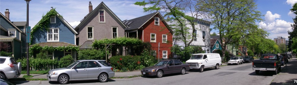
The streets and blocks of cottage lots in Strathcona are the last remaining historic residential district in Vancouver. Had the West End not converted to three-storey apartments beginning in the 1920’s, and tower apartments beginning in the 1960’s, a historic residential district may have been created there as well. However, today, the streets of Strathcona, save for a few isolated houses here and there, are all that remains in place of turn of the century residential urbanism in our city.
The pattern made by plotting all the cottage footprints in Strathcona is remarkable. It would be stronger still if we were to take the 1960’s Housing Projects down and plat that area to reflect the grain and mix of the original cottages.
Yet, in spite of the regularity and evenness of the buildout, there is plenty of room left in the area to support residential intensification. The charrette analysis shows that over time the population in these streets can double through incremental renovation and infill.
That result would be very desirable. A stable neighbourhood would be given a new license to add living space, create mortgage helper suites, and build affordable rental housing all within easy walking distance of Japantown, Chinatown, Gastown, and a new LRT on Hastings Street, and BRT on Main Street.
.

Vernon Drive Grocery
.
13. ‘The Drives’
Twelve streets named “drives” run north-south between Raymur Avenue (on the eastern edge of Strathcona), and Nanaimo Street (on the western boundary of the Hastings Townsite). The date on the old building at Admiral Seymour Elementary School (1907) is the best clue for the development period for the Drives. It coincides with the economic boom that ended in 1908.
The twelve drives cover one mile of urban land, from Glen Drive to Garden Drive including ten more drives in between. Some of the names speak of turn of the century urbanism—Glen or ‘narrow valley’, Woodland, Lakewood, and Garden. Others have attained high profile in the city, including: Clark, Commercial and Victoria. The platting is single cottage lots sprinklered with row houses. Glen Drive is two blocks east of Clark Drive, and is bisected by the furthest extremes of the False Creek Flats.
The intrusion of Modern planning is also evident here. Industrial zoning has put warehouses anywhere and everywhere, ignoring patterns set by the older warehouse and factory buildings. The Jane Jacobs motto about preserving neighbourhood fabric was not followed here.
.

Admiral Seymour Elementary 1907
.
Neighbours on Vernon Drive speak of another kind of intrusion: the drugs and street workers that come from next door. They talk about the problems with infestations and the lack of social functioning at the Raymur housing project.
This is yet another Vancouver neighbourhood that clings to life on the strength of the people, the school, the grocery, and the superb scale of its few streets and blocks that escaped the Modern planning blight that has them surrounded.
Neighbourhood chatter bubbles up near every pocket of remaining houses, row houses and cottages. They speak about values of community and values of place, and about the reality of living in a (barely) sustainable urbanism.
These neighbourhood people make eager listeners to a message of an incremental intensification with products that will reinforce the human scale of what has survived. They are interested in the idea of implementing transportation to take cars off the road, and give drivers a viable, efficient alternative. They are expert and articulate about their local place.
©˙Lewis N. Villegas, Vancouver, December/June 2011
* * *
The Quartier Principles
The quartier is the cellular unit of the city [see Leon Krier, The Architecture of Community, 2010]. Shaped as a function of easy walking distance, and inflecting to the unique characteristics of each locality, the quartier describes the footprint—or the physical limit—of the human experience of place.
The quartier sets up in a core-periphery pattern. Finer grain platting and a higher intensity of uses present as we move from edge to centre. Within the footprint of the quartier we will build human scale; livable streets; mixed uses; and ground oriented buildings of urban density.
The quartier overlays the same footprint as the transit catchment making it a constituent part of local and regional transportation systems.
Lewis N. Villegas, “The Gastown Principles”, Vancouver, March 2011
